


Southeast South Dakota (Outside Sioux Falls City) PUMA, South Dakota
About
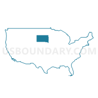
Outline
+PUMA%2c+South+Dakota_A280.png)
Summary
| Unique Area Identifier | 193972 |
| Name | Southeast South Dakota (Outside Sioux Falls City) PUMA |
| State | South Dakota |
| Area (square miles) | 3,917.52 |
| Land Area (square miles) | 3,884.92 |
| Water Area (square miles) | 32.60 |
| % of Land Area | 99.17 |
| % of Water Area | 0.83 |
| Latitude of the Internal Point | 43.29432400 |
| Longtitude of the Internal Point | -97.01406420 |
Maps
+PUMA in South Dakota.png)
Graphs
Select a template below for downloading or customizing gragh for Southeast South Dakota (Outside Sioux Falls City) PUMA, South Dakota
+PUMA%2c+South+Dakota_T0.png)
+PUMA%2c+South+Dakota_T1.png)
+PUMA%2c+South+Dakota_T2.png)
+PUMA%2c+South+Dakota_T3.png)
+PUMA%2c+South+Dakota_T4.png)
+PUMA%2c+South+Dakota_T5.png)
+PUMA%2c+South+Dakota_T6.png)
+PUMA%2c+South+Dakota_T7.png)
+PUMA%2c+South+Dakota.png)
Neighbors
Neighoring Public Use Microdata Area (by Name) Neighboring Public Use Microdata Area on the Map
- Jackrabbit Region PUMA, SD
- Northeast Nebraska PUMA, NE
- Sioux Falls City PUMA, SD
- Sioux, Clay, Dickinson, O'Brien, Lyon, Emmet, Palo Alto & Osceola Counties PUMA, IA
- Southwest Minnesota PUMA, MN
- Woodbury & Plymouth Counties--Sioux City PUMA, IA
Top 10 Neighboring County (by Population) Neighboring County on the Map
- Minnehaha County, SD (169,468)
- Woodbury County, IA (102,172)
- Lincoln County, SD (44,828)
- Sioux County, IA (33,704)
- Plymouth County, IA (24,986)
- Yankton County, SD (22,438)
- Dakota County, NE (21,006)
- Union County, SD (14,399)
- Clay County, SD (13,864)
- Lyon County, IA (11,581)
Top 10 Neighboring County Subdivision (by Population) Neighboring County Subdivision on the Map
- Sioux Falls city, Minnehaha County, SD (132,793)
- Sioux City city, Woodbury County, IA (82,678)
- Sioux Falls city, Lincoln County, SD (21,095)
- Yankton city, Yankton County, SD (14,454)
- Vermillion city, Clay County, SD (10,571)
- Brandon city, Minnehaha County, SD (8,785)
- Harrisburg city, Lincoln County, SD (4,089)
- Tea city, Lincoln County, SD (3,806)
- Dell Rapids city, Minnehaha County, SD (3,633)
- West Yankton UT, Yankton County, SD (3,474)
Top 10 Neighboring Place (by Population) Neighboring Place on the Map
- Sioux Falls city, SD (153,888)
- Sioux City city, IA (82,684)
- Yankton city, SD (14,454)
- Vermillion city, SD (10,571)
- Brandon city, SD (8,785)
- Harrisburg city, SD (4,089)
- Tea city, SD (3,806)
- Dell Rapids city, SD (3,633)
- Canton city, SD (3,057)
- Hawarden city, IA (2,546)
Top 10 Neighboring Unified School District (by Population) Neighboring Unified School District on the Map
- Sioux Falls School District 49-5, SD (143,629)
- Sioux City Community School District, IA (83,145)
- Yankton School District 63-3, SD (20,134)
- South Sioux City Community Schools, NE (17,700)
- Brandon Valley School District 49-2, SD (16,026)
- Harrisburg School District 41-2, SD (15,963)
- Vermillion School District 13-1, SD (12,235)
- Madison Central School District 39-2, SD (8,762)
- Pipestone Area School District, MN (7,718)
- Dakota Valley School District 61-8, SD (6,278)
Top 10 Neighboring State Legislative District Lower Chamber (by Population) Neighboring State Legislative District Lower Chamber on the Map
- State House District 10, SD (35,025)
- State House District 22A, MN (34,781)
- State House District 4, IA (30,923)
- State House District 11, SD (30,071)
- State House District 12, SD (29,821)
- State House District 3, IA (29,741)
- State House District 1, IA (29,391)
- State House District 9, SD (29,046)
- State House District 16, SD (23,892)
- State House District 25, SD (22,548)
Top 10 Neighboring State Legislative District Upper Chamber (by Population) Neighboring State Legislative District Upper Chamber on the Map
- State Senate District 22, MN (71,339)
- State Senate District 2, IA (60,664)
- State Senate District 1, IA (57,231)
- State Senate District 17, NE (36,601)
- State Senate District 10, SD (35,025)
- State Senate District 40, NE (31,744)
- State Senate District 11, SD (30,071)
- State Senate District 12, SD (29,821)
- State Senate District 9, SD (29,046)
- State Senate District 16, SD (23,892)
Top 10 Neighboring 111th Congressional District (by Population) Neighboring 111th Congressional District on the Map
- Congressional District (at Large), SD (814,180)
- Congressional District 1, MN (644,787)
- Congressional District 1, NE (626,092)
- Congressional District 5, IA (577,453)
- Congressional District 3, NE (561,378)
Top 10 Neighboring Census Tract (by Population) Neighboring Census Tract on the Map
- Census Tract 11.06, Minnehaha County, SD (9,727)
- Census Tract 101.04, Lincoln County, SD (9,364)
- Census Tract 203, Union County, SD (7,578)
- Census Tract 101.02, Lincoln County, SD (6,734)
- Census Tract 18.03, Minnehaha County, SD (6,580)
- Census Tract 9663.02, Yankton County, SD (6,575)
- Census Tract 11.05, Minnehaha County, SD (6,085)
- Census Tract 9659, Clay County, SD (5,724)
- Census Tract 103, Minnehaha County, SD (5,590)
- Census Tract 9662, Yankton County, SD (5,556)
Top 10 Neighboring 5-Digit ZIP Code Tabulation Area (by Population) Neighboring 5-Digit ZIP Code Tabulation Area on the Map
- 57106, SD (39,852)
- 57103, SD (34,480)
- 57104, SD (25,901)
- 57078, SD (19,121)
- 57108, SD (17,267)
- 68776, NE (15,447)
- 57110, SD (12,309)
- 57069, SD (11,988)
- 57005, SD (10,473)
- 57042, SD (8,415)